DOC retrieval using remote sensing and machine learning
Exploration of the potential of machine learning in the retrieval of dissolved organic content (DOC) concentrations by remote sensing in the Congo River. The initial assumption that machine learning algorithms perform better than the usual simpler algorithms was verified.

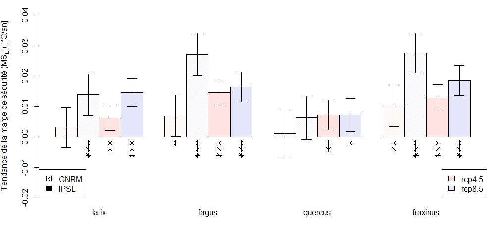
Late frosts projection
for 2100
During my thesis, I was interested in predicting how the risk of late frosts will evolve in the context of climate change for Walloon forests.
Thematic mapping of France
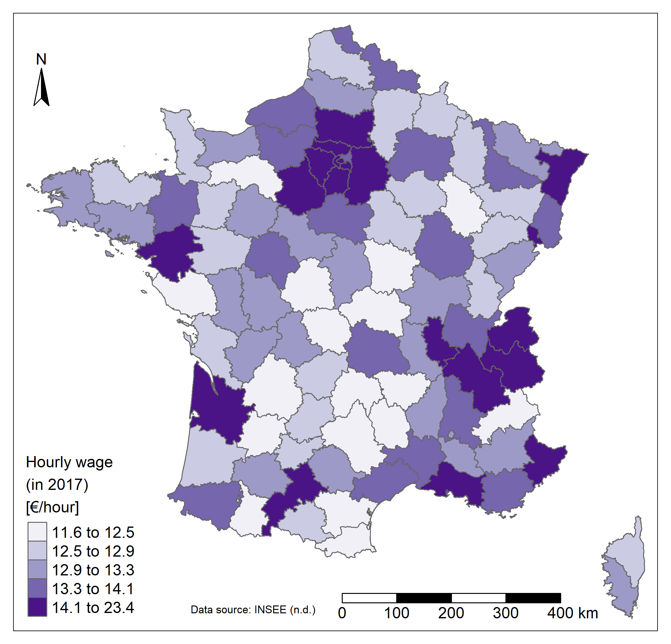
This project aimed to study the spatial patterns of different types of variables in metropolitan France, to the department level. Economic, demographic and geographic data are analyzed.
Land cover classification by remote sensing
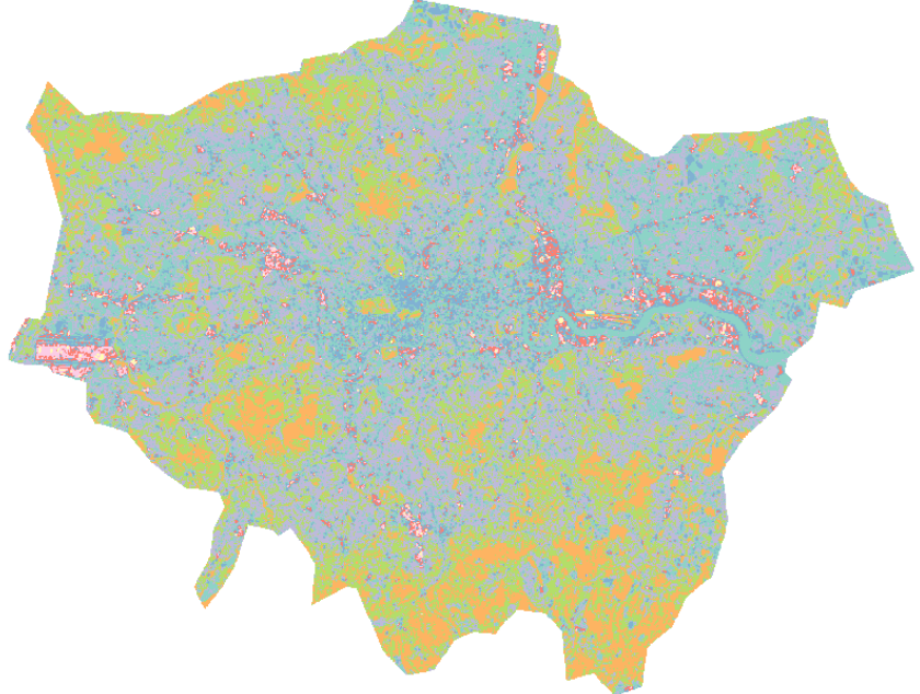
The main objective of this project was to explore the automation of land cover classification based on multiple spectral bands from satellite imagery through the construction of a function.
- Design: HTML5 UP